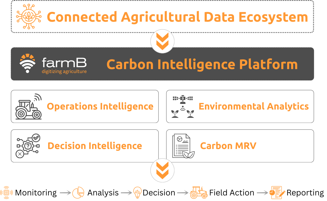
Connecting agricultural data sources, digital systems and field workflows within a unified Carbon Intelligence environment.
The farmB Carbon Intelligence platform brings together operational, environmental, geospatial and analytical data from across the agricultural ecosystem. Through live integrations, supported data workflows and configurable connectors, heterogeneous data sources are incorporated into a unified environment for monitoring, analytics, decision support and Carbon MRV.
The platform is designed to operate across different sensing and data-provider ecosystems, without being restricted to a single manufacturer, device or technology.
From Agricultural Data to Field Action
Connecting observations, systems and human workflows with actionable agricultural intelligence.
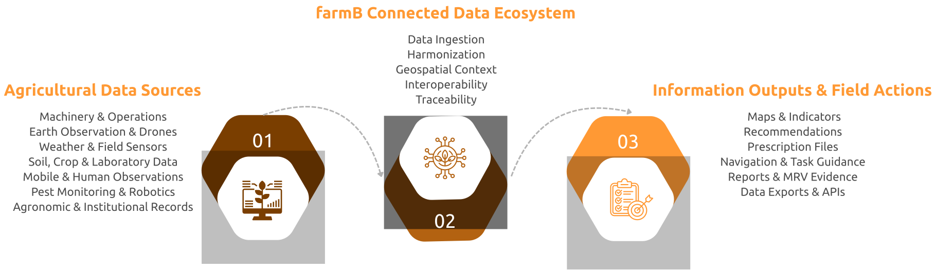
farmB connects heterogeneous agricultural data with analytical and operational workflows, enabling information to move from observation and measurement to decision, field implementation and reporting.
Agricultural Data Sources
Carbon Intelligence is built on the combination of multiple data sources across the agricultural system. farmB connects operational, environmental, geospatial, analytical and human-generated information through live integrations, supported workflows and configurable connectors.
Each data category can support monitoring, analytics, decision-making, field implementation and Carbon MRV within the same connected environment.
Field activities, machinery records, input applications, prescription maps, yield data and operational parameters provide evidence of how agricultural practices are implemented.
How it connects: Live integrations · Structured file imports · Machine-compatible exports · Configurable OEM connectors
Current support
 John Deere Operations Center
Multi-brand prescription-file generation 
Yield maps and machinery-generated datasets
Additional OEM systems
What it enables
- Machine-ready prescription files
- Field-operation records
- Application and coverage maps
- Yield and performance maps
- Operational-efficiency indicators
farmB supports both automated machinery connectivity and multi-brand file-based workflows, allowing operational information to move between the platform and field equipment.
Satellite and drone-based observations provide spatial and temporal information on crop development, field variability and environmental conditions across agricultural holdings.
How it connects: Operational data feeds · Geospatial file workflows · Expert-assisted processing · Advanced sampling workflows
Current support
Satellite imagery and derived products
Drone orthomosaic ingestion 
Patented adaptive UAV sampling
Additional aerial datasets
What it enables
- Vegetation and environmental indices
- Crop-condition maps
- Management zones
- Anomaly identification
- Targeted sampling locations
- Navigation to field-observation points
Earth Observation and aerial data are combined with field information to support spatial analysis, targeted observations and field-level decisions.
Meteorological providers, connected weather stations and field sensors support continuous monitoring of weather, soil and crop-related conditions.
How it connects: Live integrations · External data feeds · IoT connectivity · Configurable sensor connectors
Current support
Libelium
Doktar
External meteorological providers
Additional weather stations and sensors
What it enables
- Current and historical weather data
- Forecasts and alerts
- Growing Degree Days
- Rainfall and temperature indicators
- Soil moisture and temperature trends
- Inputs for agronomic decision support
The modular connector architecture allows farmB to incorporate additional weather stations and field sensors where APIs or structured data access are available.
Laboratory analyses and proximal sensing measurements provide field-level evidence on soil properties, crop status, nutrient conditions and soil organic carbon.
How it connects: Structured analytical datasets · Georeferenced imports · Proximal sensing workflows · Configurable laboratory connectors
Current support
Laboratory datasets
NIR and proximal sensing data
AgroCares
Additional laboratories and sensing devices
What it enables
- Soil and nutrient maps
- Soil organic carbon indicators
- Crop and tissue-analysis information
- Management zones
- Nutrient-management support
- Carbon MRV evidence
farmB combines analytical measurements with geospatial and operational data without limiting the platform to a single laboratory or sensing provider.
Mobile workflows connect human expertise and field-level evidence with the platform through georeferenced observations, images, scouting records and guided field activities.
How it connects: Direct mobile input · Phone camera · GPS and navigation · Structured field records
Current support
farmB mobile applications
Georeferenced phone images
Manual scouting and field observations
Guided navigation to sampling and inspection points
What it enables
- Georeferenced images
- Field notes and checklists
- Crop, pest and symptom observations
- Sample identification
- Navigation to predefined locations
- Task confirmation and timestamps
- Traceable field evidence
Mobile workflows create a direct connection between digital intelligence, human expertise and the execution of activities in the field.
Connected monitoring systems, agricultural robots and edge devices provide specialized biological, operational and telemetry information directly from the field.
How it connects: Live integration · Mobile observations · Configurable field-system connectors · Edge connectivity
Current support
e-Funnel
Manual scouting and mobile observations
Additional connected traps
farmB Robotics Box
ROS-enabled systems
Robot telemetry and mission data
What it enables
- Current and historical pest counts
- Population trends and alerts
- Targeted scouting
- Crop-protection decision support
- Robot telemetry
- Mission and route information
- Task-execution status
- Bidirectional cloud–robot communication
farmB currently supports live pest-monitoring data through e-Funnel and customized cloud connectivity for agricultural robotic and edge systems.
Farm, agronomic and organizational records provide the historical, management and traceability context required to interpret operational and environmental data.
How it connects: Manual and mobile records · Structured file imports · Enterprise interfaces · Project-specific APIs
Current support
Farm and agronomic records
Structured datasets and file imports
Enterprise and institutional systems
External APIs
What it enables
- Field boundaries and crop records
- Crop plans, varieties and rotations
- Practice and input histories
- Infrastructure and machinery records
- Supply-chain traceability
- Contract-farming information
- Sustainability indicators
- Activity records for Carbon MRV
- Reports and structured exports
These records provide the contextual layer connecting field observations and operations with reporting, traceability and Carbon MRV requirements.
Connected Data in Practice
Agricultural data from multiple sources is transformed into field-level maps, analytical indicators, operational workflows and actionable guidance within the farmB platform.
From Field Data to Machine-Ready Application
Operational, geospatial and agronomic data can be combined to generate variable-rate prescription maps and machine-compatible application files.
Connected data: Machinery records · Field boundaries · Crop and soil information
What it enables: Prescription maps · Machine-ready files · Application records
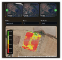
From Earth Observation to Field-Level Insight
Satellite and aerial data are combined with field boundaries and historical observations to monitor crop conditions, identify spatial variability and guide targeted interventions.
Connected data: Satellite imagery · Drone data · Field boundaries
What it enables: Indices · Field maps · Management zones · Sampling locations
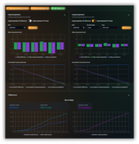
From Weather Data to Environmental Context
Data from weather providers, connected stations and environmental sensors are incorporated into farm-level monitoring and analytical workflows.
Connected data: Weather providers · Weather stations · Field sensors
What it enables: Forecasts · Historical trends · Growing Degree Days · Environmental indicators
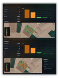
From Analytical Measurements to Spatial Intelligence
Soil, crop, laboratory and proximal-sensing measurements are georeferenced and combined with field information to support mapping, nutrient management and Carbon MRV.
Connected data: Laboratory data · NIR measurements · Sampling locations
What it enables: Soil maps · Nutrient indicators · SOC information · Management zones
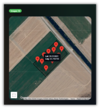
From Digital Intelligence to Field Execution
Mobile workflows connect platform-generated information with human observations and field activities through georeferenced images, guided navigation and task confirmation.
Connected data: Phone camera · GPS · Human observations · Platform instructions
What it enables: Field evidence · Sampling navigation · Inspection records · Completed tasks
From Connected Data to Carbon Intelligence
Across these data sources and workflows, farmB harmonizes agricultural information within a common spatial, temporal and operational context. This connected data environment provides the foundation for Operations Intelligence, Environmental Analytics, Decision Intelligence and Carbon MRV.
By connecting observations, field activities and analytical data, the platform enables information to move from monitoring and analysis to decisions, field implementation, reporting and verification-ready evidence.